Climate considerations in Bay Point
Bay Point sits on a north-facing slope above open brackish water, which moderates the summer heat found a few miles inland and replaces it with something harder on structures: humidity that stays elevated year-round, afternoon wind off the water for most of the year, and roughly 15–17 inches of rain arriving between November and March driven sideways rather than falling straight down. There is no sustained hot dry stretch to push accumulated moisture back out of framing. Decay here progresses steadily and quietly rather than dramatically, and probing inspection rather than visual-only review is the right standard on older stock. What makes the community distinctive, though, is not the conditions themselves but where they land.
Everything arrives on the same side
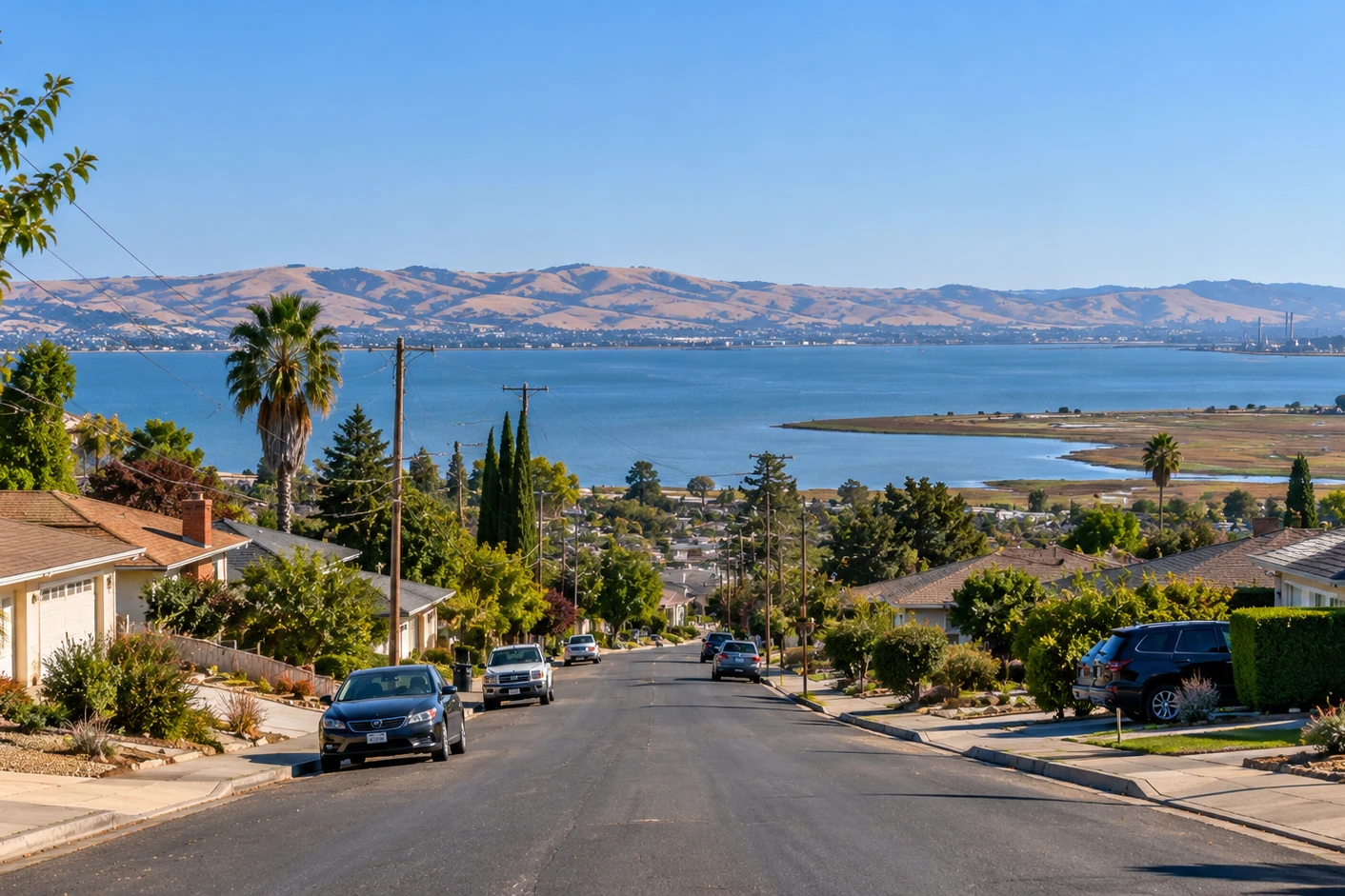
On most properties anywhere else, the four things that weather a structure hardest arrive on different faces. The sunny side, the windward side, the downhill side where site water collects, and the side the deck is built on are usually three or four separate elevations, so wear is distributed and no single face takes all of it. Bay Point is laid out as a slope running down to the water, and that alignment collapses. The view is downhill, so the deck is on the downhill side. The water is downhill, so that side takes the most brackish moisture. The prevailing wind comes off the water, so that same side takes the wind load and the wind-driven rain. And site drainage runs downhill, so it concentrates there too. Four conditions, one elevation, year after year. The practical consequence is that deterioration here concentrates instead of spreading: a building can present perfectly well from the street and have its worst-weathered assembly round the back, where the deck is and where nobody but the owner looks. We inspect the bay-facing elevation as its own exposure zone and report on it separately, because folding it into a whole-property average understates it every time.
Shoreline to hilltop
Bay Point is compact but it climbs several hundred feet from the shoreline to the upper streets, and the exposure difference across that rise is real. Properties low on the slope near the water take direct brackish moisture and the full wind, and genuinely warrant upgraded hardware on their exposed elevations. Higher up the exposure drops off meaningfully, and specifying a hilltop property as though it sat on the shoreline means paying for corrosion resistance that is not being called upon. We have seen both errors: shoreline properties specified as though they were ordinary suburban lots and failing early, and hilltop properties quoted marine-grade throughout for no reason. The fix is neither complicated nor expensive — it is checking elevation and orientation during the assessment and specifying by what the structure actually faces, which also means being willing to tell an owner that the cheaper specification is the correct one.
The ZIP code points to the wrong office
Bay Point is unincorporated, which means permits for structural deck and balcony work go through Contra Costa County, and SB 721 and SB 326 inspection reports are filed with County Code Enforcement. The complication is postal. Bay Point shares its ZIP code with the incorporated city immediately next door, so the single most visible piece of information on an owner’s own correspondence points at a city building department that does not cover them. We have met owners who submitted to that office in good faith and lost weeks before the mistake surfaced — and a rejected submission does not fail quickly, it fails after the wait and then starts again with the correct authority. Checking the record against the address takes a few minutes and removes the problem entirely. We do it before filing anything.
Common building stock we work on
Bay Point’s residential stock is predominantly post-war single-family, with substantial development through the 1950s to 1970s and later infill since, laid out across the slope with decks added over the decades to take advantage of the view. Those decks carry the exposure pattern described above along with connection details, fastener schedules, and railing geometry from whatever era they were built in. Apartment and small multi-family buildings along the Willow Pass Road, Bailey Road, and Port Chicago Highway corridors form the SB 721 inventory, mostly mid-century through 1980s construction with original waterproofing and connection hardware now well past service life. Shoreline-area properties in Shore Acres and the lower streets carry the heaviest exposure in the community. Our certified construction crew scopes every project to the era, the elevation, the orientation, and the code in effect at installation.
Neighborhoods served
Our certified Bay Point crew covers Shore Acres, Clearland, the hilltop neighbourhoods, the Willow Pass Road corridor, the Bailey Road corridor, the Port Chicago Highway area, the Canal Road area, Alves Lane, Driftwood Drive, Anchor Drive, and the wider Bay Point community. ZIP code 94565 covers the community — see the note above on what that does and does not tell you about jurisdiction.
What we typically see
Across our Bay Point inspections, our company most often documents: (1) a single elevation in substantially worse condition than the rest of the same structure, because the wind, the moisture, the drainage, and the deck all arrive on that one face — a Bay Point-specific pattern created by how the community sits on the slope; (2) corroded connectors and fasteners concealed inside assemblies on the bay-facing side while identical hardware elsewhere on the property remains sound; (3) wind-driven water entering at flashing seams and penetrations on the exposed elevation; (4) specification errors in both directions — shoreline properties detailed as ordinary suburban lots, hilltop properties quoted marine-grade throughout; (5) owners who had identified the wrong permitting authority from their ZIP code; (6) railings on pre-2000 stock that fall short of the current CRC 42-inch height and 4-inch sphere rule. Every finding is captured in a written assessment with prioritized repair, replacement, or restoration scope.
Emergency response & remodeling
For Bay Point properties with acute safety issues — sagging framing, loose railings, visible rot or corrosion at load-bearing connections, red-tagged structures, or winter storm damage on the exposed elevation — our emergency repair crew responds within 24–48 hours with temporary shoring and code-compliant stabilization. Storm damage here concentrates on the bay-facing side, and we prioritise accordingly during the season. We also handle full deck and balcony remodeling, with hardware and detailing specified by the exposure each elevation actually has rather than applied uniformly across a property.